
Day 4
With no goals for the day, other than getting to Moab, we took the chance to sleep in slightly. Once we made the decision to get up however, Alyssa went down for breakfast while I started loading the car, in an attempt to save time. When I had traveled between the two towns a year prior, US-550 had been closed due to a rock slide which ended up being fortunate, since my motorcycle was damaged and unable to shift between gears. Today, however, things were different and there was nothing to stop a trip up the "Million Dollar Highway." Just a few miles outside of town, we spotted a strange formation on the side of the road: water bubbling from an orange-colored rock dome. We pulled over to explore and read the placard that described it as the "Pinkerton Hot Springs." After a photo, we got back into the car, and drove off.
The road twisted and turned, carving its way north through the mountain pass. We went with it, enamored by the gorgeous views as we climbed above the snow-line. Alyssa, who always been more fond of beaches than mountains, was even beginning to change her views, commenting "I think I just like the outdoors."
As someone who's confident in my driving ability, I enjoy driving fast on narrow, two-lane, twisting roads like what we were on. Unfortunately, many other people drive slower, whether through caution or by looking at the scenery surrounding them. So, once I got the chance to pull off onto an overlook on the side of the road, I took it and used the opportunity to gain some space between myself and those ahead of me. At one such stop, I noticed people crossing the road to see the sights from the other side. While Alyssa was looking at something else, I crossed over myself to find a stream pouring from a cave just under the road. I spent a few moments photographing the site, and returned to find Alyssa annoyed that I had ran off without telling her.


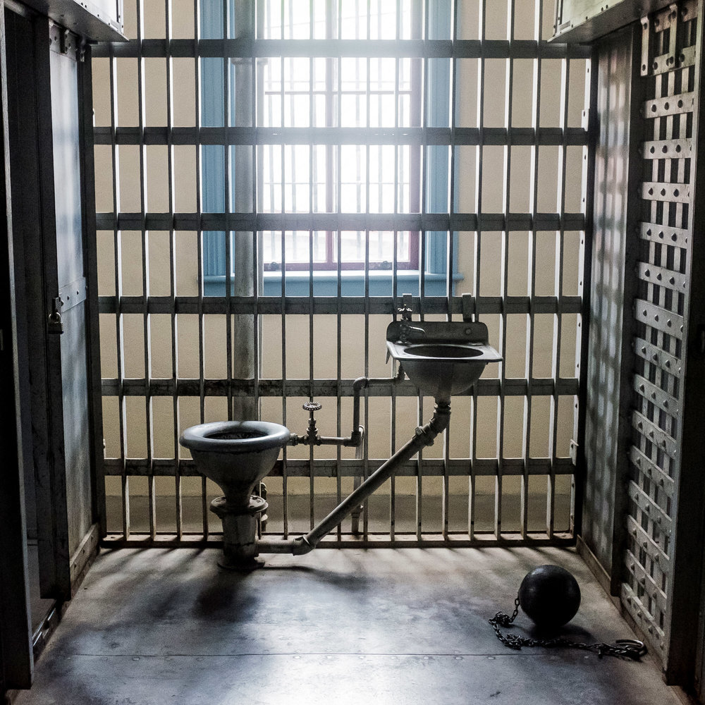
We continued on and soon reached the town of Silverton, where we could see the steam train from Durango arriving. We drove down the town's only paved road while I explained a few of the details I had heard when I had taken the train the year before, about how the road behind the main street had been filled with brothels, and about how much crime the mining town once had. It's fitting then, that as we reached the far end of town, we came across the Silverton Mining Museum, in the place of what used to be the town jail.
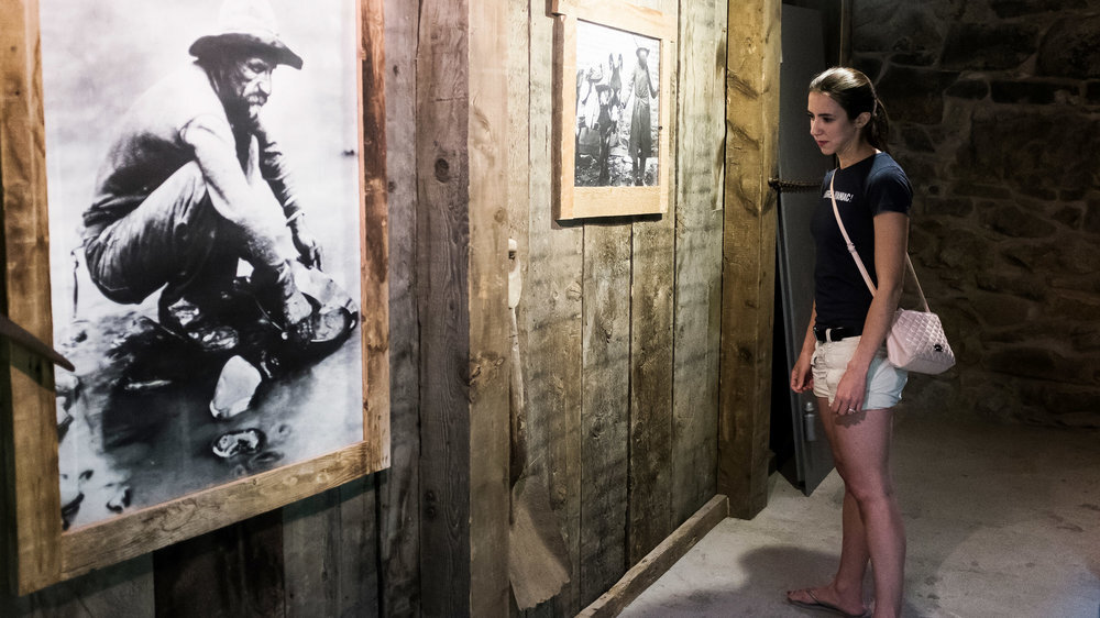
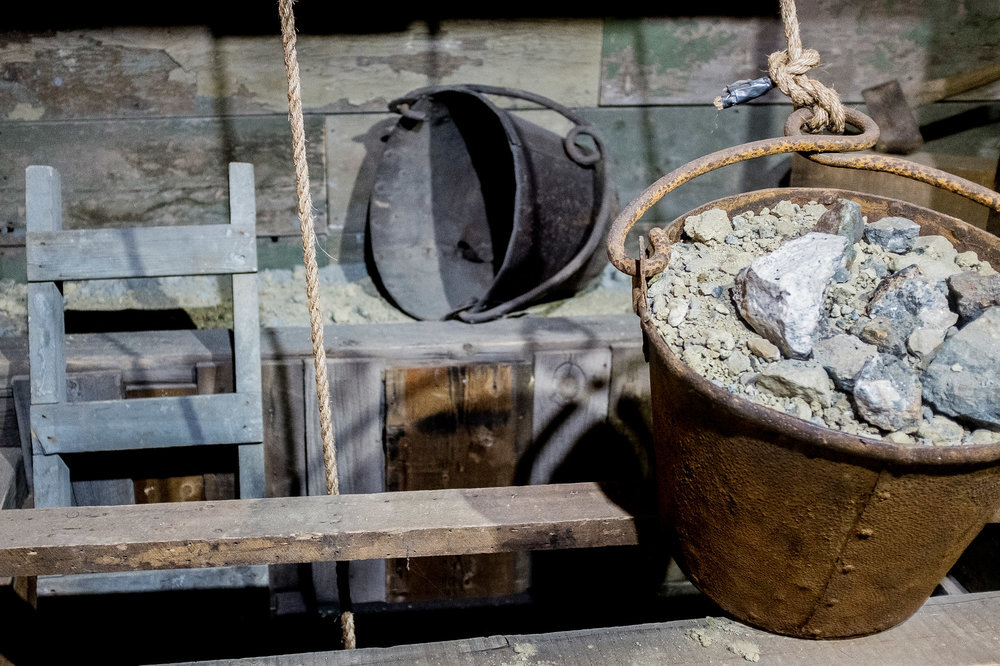
At a price of $7 per person, we walked inside (after discovering the door with a "Not an Entrance" sign was really an entrance, the sign intending to prevent people from entering without paying.) We toured through the building, exploring the escape-proof jail, the mineral collection, and the various mining tools and artifacts. There was even a small section on photography that included several vintage cameras. The museum seemed to keep going, with either another room or entire floor to explore. Eventually we walked away, thinking it was well worth the admission price.

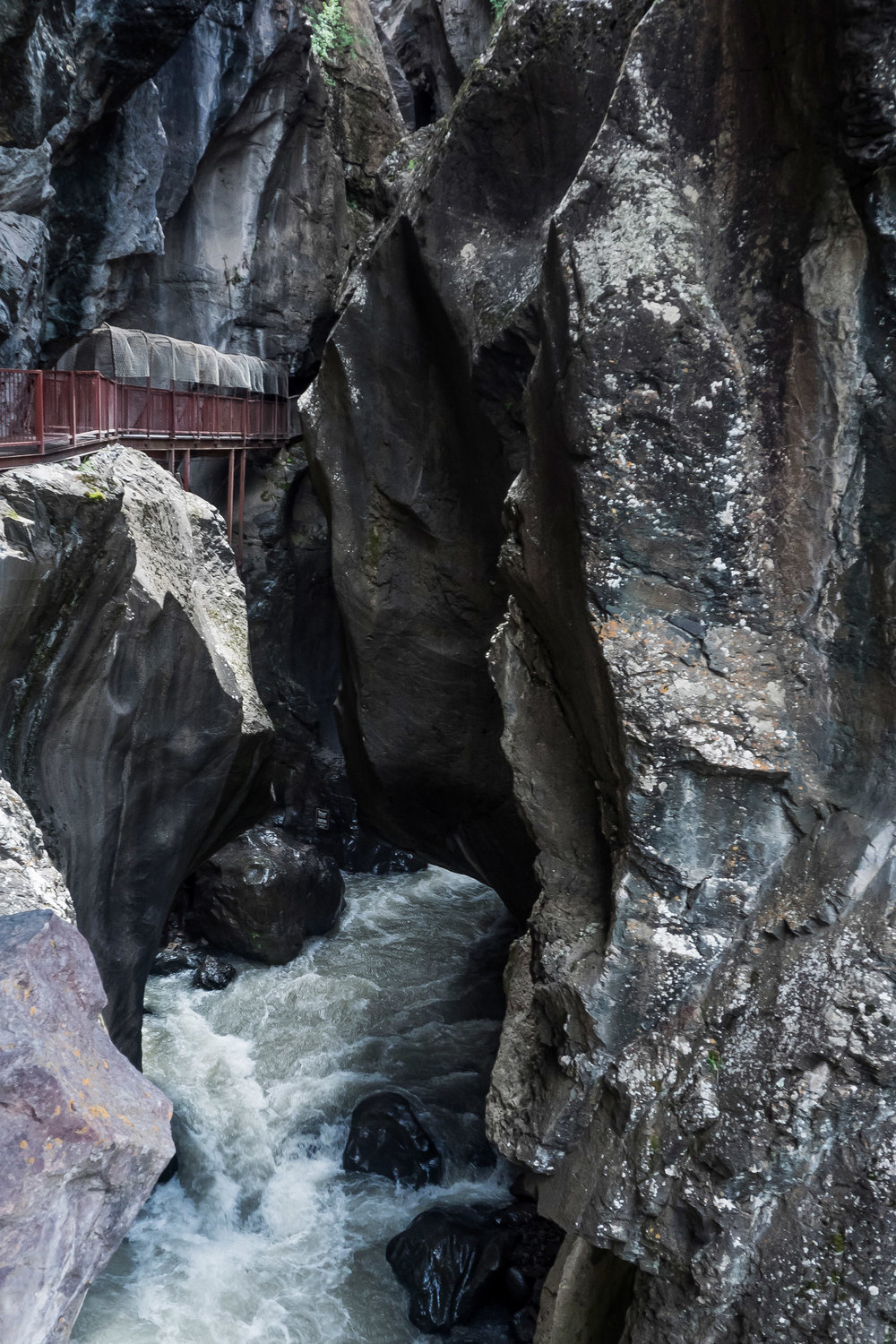
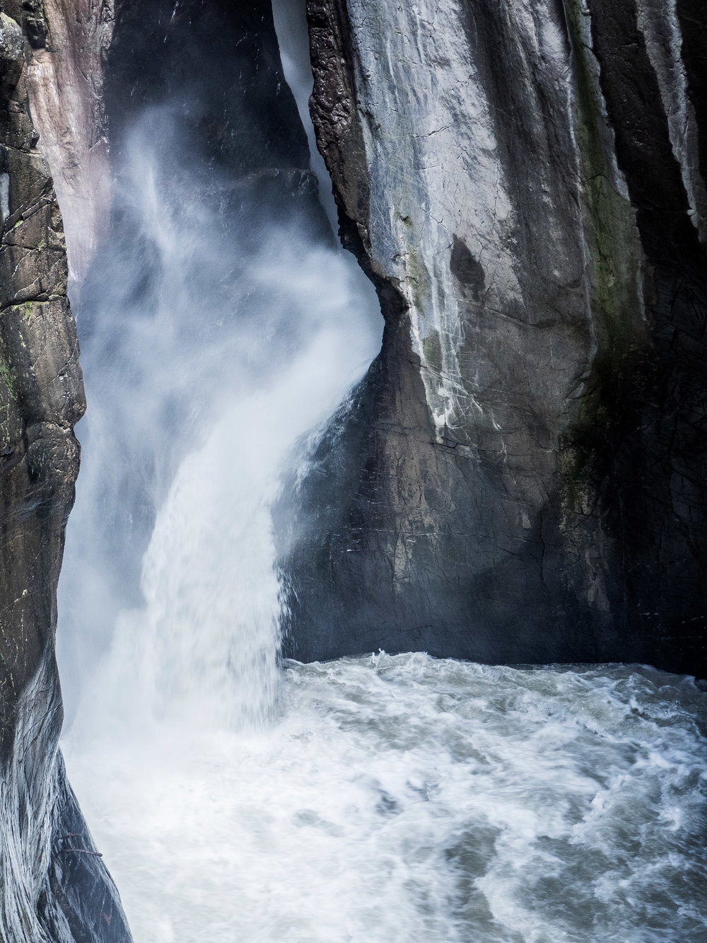
Back on the road, we resumed our drive through the mountains until I saw a small indication on my GPS, a waypoint I had marked over a year before. Box Canyon Falls, outside of Ouray, was a stop I had learned about during planning for my cross-country trip, and later forgotten about. We parked in a nearby parking lot, paid Alyssa's admission (no fee for military members,) and were given directions to the falls.
There were a few routes to take. A short trail of only a few hundred yards would take you directly to the base of the falls, while a nature trail would take you on a much longer trek. A third route, roughly 1/4 mile long and including a climb up 90 stairs, would take you to a bridge high above the falls.
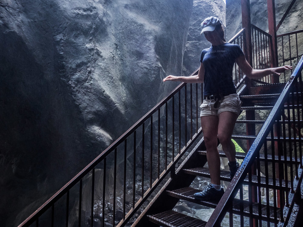
We chose to take the short route, which led us onto a narrow metal catwalk suspended along the side of the canyon. As we approached the falls, the catwalk ended in a set of stairs descending towards the canyon floor. Roughly halfway down the steps, we were hit with the cold mist and wind from the torrent of water being poured into the room. On the warm day, it felt refreshing.
We made our way back and chose to take the trail to the top of the falls. Between the stairs at the start of the trail and the elevation gain to reach the overlook, I almost regretted doing this trail last, wanting the mist from the base of the falls to cool me off once more.
Reaching the top, where aside from the view of Ouray, I was unimpressed. We turned and hiked back to the base of the trail, where we found a number of chipmunks feeding on seeds from a nearby bird feeder. We spent a few minutes watching them scurry around, before heading back to the car to continue on our way.

Sometime in the planning process, I had apparently changed routes, intending to arrive in Moab from the south. I began to realize that's not how my GPS was navigating me, instead taking me to I-70 where I'd reach the city from the north. While it wouldn't make a big difference in time, it annoyed me because I-70 was how I planned on leaving the city, and I didn't want to travel the same route multiple times.
Things worked out and, when we stopped at the Utah welcome center, we received a poster of our choice, just for filling out a survey. We picked one showcasing Delicate Arch in Moab's Arches National Park, since that's where we were heading to.
Soon, we arrived at Moab Under Canvas for our "glamping" experience. I had requested a tent that was isolated away from the others, since we'd be spending our anniversary there and didn't want the annoyances of hearing other people's conversations, radios, or other camping noises, and the staff accommodated us nicely with a tent that was next to only storage tents.
We took some time to familiarize ourselves with the campground, and the excessive dry heat reminded me of times in the Middle East. I only wish the tents and bathrooms there had been as nice as these.
