
Day 5
The morning came, and I felt good. I had slept in a comfortable bed, and my bike was back at 100%. My uncle had already left for work but my aunt was home for the day. She called him, letting him wish me farewell. I was offered breakfast, but since I’ve always been a two-meal kind of guy (lunch and dinner), I declined. Still, she insisted and I settled for some orange juice. Except, she didn’t have any, and rushed to the store to pick up a half-gallon for me. I felt bad for her having to do that, but at least it gave me a chance to turn the bike around in the garage, avoiding the need to back the loaded machine up the steep driveway. She returned, I drank, and put the container in my cooler for later mornings. It could be useful over the next few nights of camping. We said our goodbyes and I was off, with clear skies above me and a working bike below. As far as interstates go, I’ve always liked the part west of Little Rock and today was no exception, with the morning sun reflecting off the river as I crossed over it. Knowing today would be my first major day of backwood trails, some on the TAT and some not, I topped off my tank and filled up my two spare fuel cans, eager to explore the Ozarks.
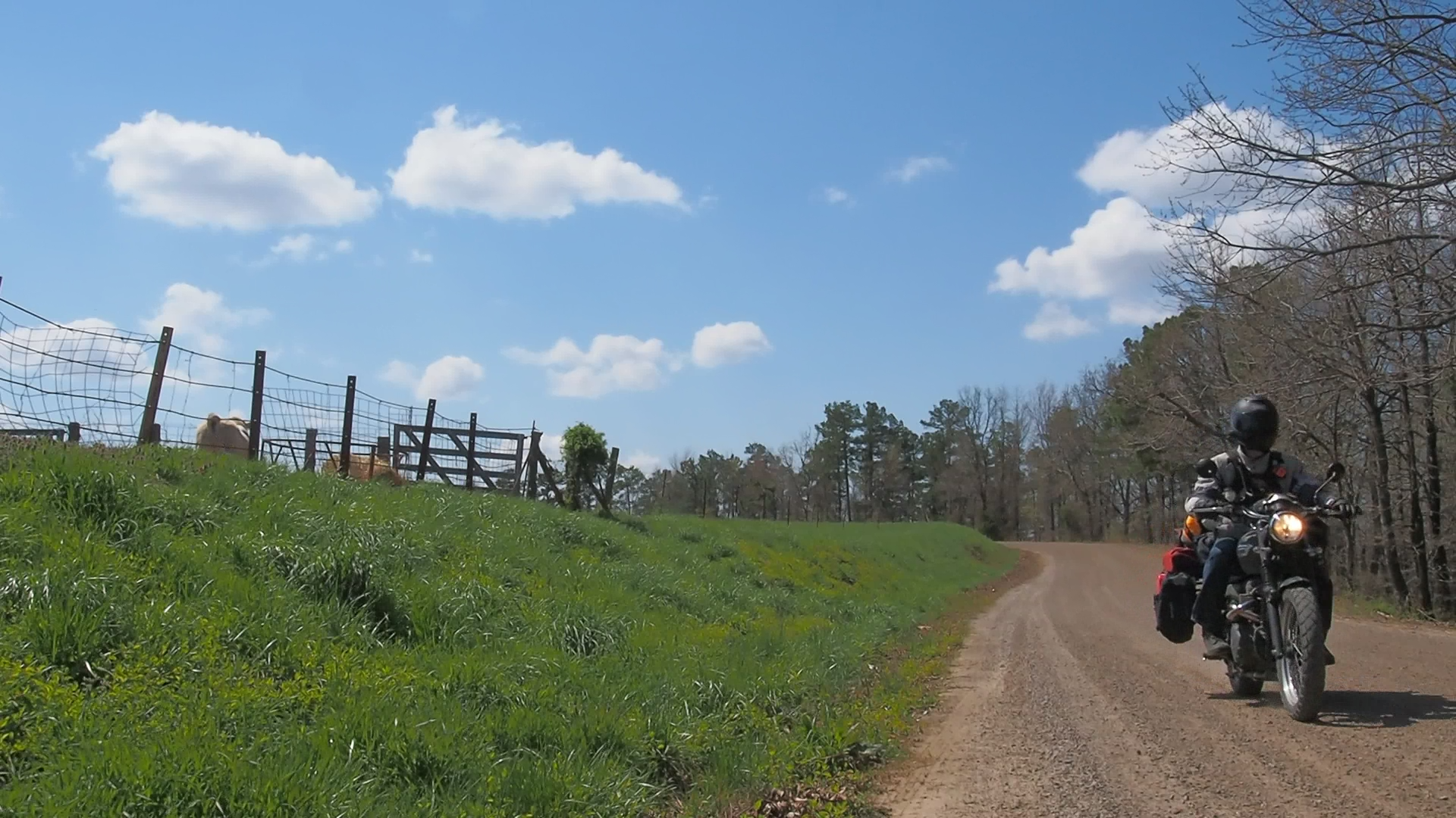
I soon found myself on a mountain logging road, packed dirt and gravel suitable enough for heavy 18-wheelers and many tons of chopped trees. No longer worrying about a crippled bike and sudden sharp turns, I managed a comfortable speed of 40-50mph, a long trail of dust snaking its way from my back tire.

As I traveled further north, the landscape started to change. What was short leafy trees had become tall pines. Mile after mile the trail went, meandering its way across the Ozarks, but because it was a logging trail, it had long stretches of straights and softer turns than I was wanting. I still had Oklahoma to travel through, and my years of living there told me I’d get my fill of straight roads.

I ignored my planned route, and set my GPS to take me to the day’s side adventure, a small hike to see a waterfall. There’s a lot of unpaved road in that part of Arkansas and as I followed my GPS’s new routing, I traded the logging roads for farm roads, surprising me since I didn’t expect farms in the mountains.

The waterfall I had chosen to see, “Glory Hole Falls”, was something I had found on Pinterest, a social site my girlfriend introduced me to. During my planning, it had seemed unique enough and wasn’t far from the TAT trail, so I adjusted the route to include the detour. But, what Pinterest and Google don’t show is how far away from the road the fall is. I had thought it was a half-mile trek at most, and so to save a bit of time I kept my gear on as I hiked my way there. A mile later, and after a 400’ drop in elevation, I was sweating heavily, roasting in my armored jacket. Still, the view was impressive. A small hole in the ceiling of what could barely be called a cave let the mountain stream water shower down into a small pool below, before continuing to flow downhill. I rested in the cave’s shade for a bit, using some of the water to cool me off, before making my ascent back to my bike.
Needing a small rest at the bike, I chose to fill up using my spare fuel. The 2 gallons of spare fuel I brought with me nearly doubled the range of the Scrambler, having slightly larger than a 3 gallon tank, and having not passed a real town in a while, with who knows how much longer to go, I felt I needed the boost. Fueled and rested, I set off again making my way to Fayetteville where I stopped for a meal from a fast food joint outside of the University of Arkansas. People were starting to show up for a baseball game later that evening and I considered briefly staying to watch. I quickly decided against it, not wanting to drive for another two hours into Tahlequah after dark, with a headlamp that many people consider too dim. Besides, I hated setting up camp by flashlight. I crossed into Oklahoma, almost surprised that the landscape didn’t instantly turn flat and the roads straight. A short time later, I pulled into a campground I had found online a couple of weeks back but they were closed for the day, and it looked too much like an RV-park anyways. So I traveled back the way I had come for a few miles, until I reached the No Head Hollow public use area. I parked the bike, set up my tent, and settled in for the night.
